
Within Apalachicola Bay, for approximately 6 miles between Eastpoint and Yent Bayou, much of Highway 98 lies immediately adjacent to the water’s edge. Due to chronic erosion along this shoreline, and the importance of this roadway as a designated Hurricane Evacuation Route, millions of dollars have been spent trying to protect the roadway from erosion damage. In many cases, erosion during coastal storm events has damaged the roadway, requiring costly repairs.
The Apalachee Regional Planning Council is working in tandem with professional services firm, WSP, and local contractors, Franklin’s Promise Coalition, North Florida Construction, Inc, and Coastline Clearing, to enhance the habitat along this section of shoreline with a “living shoreline.
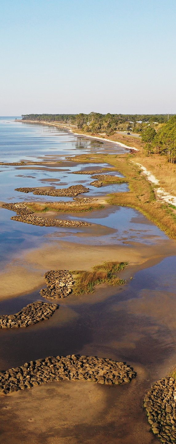
NEARSHORE HABITAT
The installation of nearshore reefs will help attenuate wave energy through their increased elevation and rough surface, which will create a calmer wave environment landward of the reefs. These reefs will become colonized with various marine species, including oysters, which will help serve as a source of larval oysters for other parts of the bay. The high density of marine life currently found on existing substrate along the shoreline provides confidence that these reefs will be productive.
INTERTIDAL MARSH HABITAT
With only minimal wave protection and adequate intertidal area, this section of coastline is expected to be able to support healthy intertidal marshes. This is reinforced by the fact that portions of the shoreline already have marsh vegetation. Although the reefs are not expected to completely stop all wave energy, they are expected to reduce the energy enough to allow marsh vegetation to thrive. Marsh plants can assist in stabilizing the shoreline by capturing sediment.


.png)
The project footprint encompasses the stretch of US-HWY 98 between 9th Street in Eastpoint, running east to Yent Bayou.


